Testing & refining the field survey method, and developing a means for assessing significance – 12th Dec (by Field Systems intern, Tessa de Ruyter)

From the 5th October to the 11th December it was my honour to be part of the Field Systems Project team. Not only was this was a great opportunity for me to test my Dutch skills in landscape research, it also gave me the opportunity to get to know the High Weald landscape, which I have come to admire.

During my placement, my primary task was, as a (Dutch) non-expert, to test the historic field survey method developed by Dr. Nicola Bannister. However, I was also responsible for finding out how we can improve and tailor this methodology in order to create an assessment framework which can be used by local authorities and planners when making decisions about development in the High Weald AONB.

During my second week I undertook a three day field survey at Little Scotney Farm, located on the Scotney Estate. My task was to see if the aforementioned survey forms could be easily used by a non-expert. However, before going out into the field I attempted to complete the forms as much as possible from my desk, with the aim of seeing if a wholly desk-based approach was a possible. After completing this initial investigatory stage, it was time to get out onto the ground and into the fields themselves. Despite having studied landscape history to postgraduate level in the Netherlands, completing the field survey – which involved spotting and recording all the lumps, bumps and other notable historic features – proved to be quite a challenge! IMG_20151012_142105
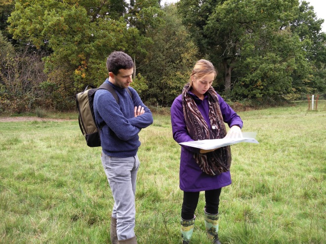
Once I had finished, all the data were entered into the geodatabase developed by the previous intern, Fred Warner.

The next step was to conduct a complete desk-based survey for Earlye Farm. To separate the desk-based data from the field survey data, a new geodatabase was created containing only the desk-based data. Ultimately, the field based approach will be compared to the desk based approach to see whether it will be possible to conduct an entire survey from the desk thus saving time and reducing costs for future users.

In addition to the surveys, I took a trip to the archives at The Keep in Brighton to mine them for any useful information about the Earlye case study site. A chat with Earlye’s resident farmer, Bill Gingell, also turned up some really useful information – something which reminded me of the importance of oral history in providing invaluable insights that you often can’t find in a record office.

Finally, I spent several weeks working hard to develop a clear and concise flowchart setting out all the checks required to effectively assess a field’s – or group of fields’ – historic significance. After a number of long discussions with Sally, Nikki and Charles, we eventually succeeded in setting up a draft flowchart which can be used to screen out significant fields and field systems throughout the High Weald. We hope that this will help highlight historically valuable and characteristic fields, enabling them to be better conserved in the future.

Setting up the geodatabase and entering the first data – 20th August (by Field Systems intern, Fred Warner)

Over the course of the last 5 weeks I have been lucky enough to be taken on as a GIS intern with the High Weald AONB Unit. My primary task has been to help develop the geodatabase into which field survey data for the fieldscapes project will be entered. This will, hopefully, aid the attempts being made to better understand fields and their interconnected nature.

During this project a number of issues became apparent; the most common of which being missing data. For example, there were instances where variables such as the historic management of boundaries were not recorded. The cause of this is likely the sheer volume of data to be collected coupled with time constraints. Although on the whole the data was complete, the main problem when it was missing is that as I am not qualified to make the necessary judgement – or data interpolation – since I have not seen the fields first-hand. Additionally, even if I had I lack the specialist knowledge to make reliable and well informed decisions.

Having discussed the matter with the field surveyor a two part solution was developed. The first part was to add catch all negative options commonly titled “uncertain”. This provided a way for me to make it clear where I am uncertain as to what should be added to the dataset due to either missing or ambiguous data. The second part was to amend the recording forms that were being used. Usually this involved adding an option called “unknown”, “uncertain”, “n/a”, or a relevant equivalent option. Doing this provided a means for the surveyor to explicitly say that they were unable to make a judgement call on that variable. In addition to this the surveyor was encouraged to mark something for every variable even if this did involve the use of the “unknown” option. For instance, if the historic management was not easily discernible then the surveyor is encouraged to use the “unknown” option instead of leaving the field blank.

The use of the option “uncertain” for the variables historic and current management.
The use of the option “uncertain” for the variables “Historic” and “Current” management

These issues – as well as others we encountered during the set-up of the geodatabase – have highlighted the importance of generating test data early on in the project. By surveying some of the case study sites at the outset and generating real data for those sites, the practical constraints of entering field survey data into a GIS system quickly became apparent and we have been able to make the necessary changes early on.

This process has proved to be an important step in designing an effective system of data capture that allows information recorded out in the field to be more seamlessly transferred into a GIS. Moreover, this initial time-investment has enabled us to avoid problems we would otherwise have encountered much further down the line, reducing the need to make time-consuming ad hoc changes.

Digitising the tithes – 23rd July (by Field Systems intern, William Gibbs)

During the last 4 weeks I have been part of the Field Systems team, working on an exciting and unique project to develop a methodology utilizing a “geographic information system” (GIS) to examine historic field systems in the High Weald AONB. GIS was used to enable the spatial analysis of all of the available geographic and historic data sources in a simple and effective manner. The aim is that this will help the team to identify important historic features and patterns.

Firstly, digital scans of the parish tithe maps (dating from the 1840s) were geo-rectified for each study site – a process which gives scanned images a spatial reference – so that this historic could be overlaid and compared with modern maps. Within the boundary of each of the case study sites, all tithe map field features were digitised using GIS software (a process that creates a digital copy of the Tithe maps). Once all case study sites have been digitised this new spatial data can be joined digitally to the information entered into the tithe schedule. Information included in the schedule includes land owner, crop type and a description of each field; therefore the consequently this information now has a spatial reference. Digitising the tithe maps has resulted in the creation a new layer of information which can be spatially interrogated and analysed, and which can be used in conjunction with other data to help identify changes to fields in the High Weald.

Feild_Systems_HW
Frant tithe map

The adjacent image shows a portion of the recently digitised Frant tithe map with the green line highlighting one of the polygons that now digitally represent each tithe map land parcel (click image to enlarge).

Drone testing begins at 1st test site – 10th July

As mentioned in a previous post we’ve now begun test flying a drone to capture aerial images of fields and field boundaries. The quadcopter – assembled and piloted by our own in-house technical expert, Matt Pitts – was flown over a field at one of our test sites, Earlye Farm for the first time last Friday. Following a pre-planned route plotted using the open-source flight programming software, Mission Planner, the quadcopter – fitted with a GoPro camera set to take pictures every few seconds – used its own internal GPS to trace the route. It’s then possible to stitch the resulting series of high resolution aerial images into a single picture of the entire field – or even transform them into a 3D landsruface model – using Agisoft PhotoScan.

That was the plan anyway. Unfortunately, however, things didn’t quite go to plan. After successfully surveying the first half of the field, the drone flew over a pocket of woodland before turning to make another pass. The only problem was it didn’t. Following a few nervous seconds waiting the drone failed to emerge from behind the woodland, prompting the survey team to run across the field and investigate what had happened. Thanks mainly to a constant and rather mournful beeping sound we were able to quickly locate the drone – along with the GoPro and its internal memory card containing all the mission’s images – in bottom of a wooded pit. It seems the drone must have clipped the tops of some unexpectedly tall ash trees right after starting its trip back across the field, causing the rotors to shatter and the bird to go into an uncontrollable flat spin (see the rather disorientating image, below, taken seconds before the crash).

DCIM999GOPRO
The drone in free-fall

Although we can’t rule out a technical failure on the drone itself, we suspect the ultimate cause was a miscalculation of the trees’ height due to the test field’s severely sloping topography (the height that the drone flies above the ground, which can be pre-set in Mission Planner, is calculated based on where the drone takes off from; the drone is therefore unable to correct its elevation even if large changes in elevation occur during its flight due to uneven topography – such as in a severely sloped field like the one we were flying in). Essentially, it seems the drone thought it was higher than it actually was when it clipped the tree canopy!

Crash site
Crash site

Although the mission was not wholly successful, we did learn a lot about how to improve our pre-flight operation procedures for future flights. What’s more, we were able capture enough imagery before the crash to stitch together a composite aerial picture of the test field (see the picture of the test field at the end of this post). Despite this small setback we’re optimistic about our future drone flights and the potential it has to provide valuable information about fields and field systems. After all, they say you learn more from failure than you do from success. And as they say in Mission Control at NASA, we will continue to “work the problem”.

Test field at Earlye Farm

Project review meeting R2, 8th July

Following trials of the field archaeology and ecology field survey together with drone flights and data input the Project Steering Group met in London to review the draft methodology and start to formulate the assessment framework. Further minor revisions to the method are likely following completion of the first case study.

HE 7056 Agenda & Actions – Review 2 Meeting 08-07-2015

HE 7056 Method Statement_Draft

Field testing the method

Flying the field boundaries – 10th July

A trial drone flight was undertaken this week at Earlye Farm. All was going smoothly until the first case study flight ended prematurely when one of the drone’s rotors caught the tip of an ash branch. Matt will be working hard to get the drone up and flying again next week.

The Project Team is using a low cost quadcopter drone with GoPro camera attachment to capture high resolution photographs and video footage of fields and their boundaries. The images will be compared with aerial photographs, LiDAR and the results of the field survey to see if the lower flying drones can provide a cost effective alternative to full field survey for an initial assessment of the historic and ecological significance of fields.

The pre-programmable flight details will also allow the same route to be flown in the future and the video footage compared to help monitor changes to the fields.

Drone no-fly zones and a summary of UK legal requirement for drone flying can be found here http://droneflight.co.uk/pages/summary-of-uk-legal-requirements

Pilot rapid grassland field survey – 3rd July

Taking advantage of the calm weather the Project’s grassland ecologist, Kate Ryland, surveyed the first case study area in Benenden, Kent, from public footpaths to see if any patches of species rich grassland survive. The project is exploring the relationship between the presence of historic features in fields and species-rich grassland whose soils tend not to have been extensively ploughed suggesting historic features and buried archaeology may survive better in such grasslands.

Since the 1940’s the UK has lost 97% of its lowland species- rich grassland and what remains continues to be lost at a rate of 2 – 10% per annum*. In the case study area Kate found very few of the native grasses and flowers associated with species-rich grassland suggesting the situation in Benenden is consistent with the national picture.  This does not mean that are area is poor for all wildlife; the mix of mature hedges, old trees, ancient woodland and ponds provide habitats for many species and Kate was surprised on her walk by a badger and a fox cub.

*Ref – UKBAP: Lowland Meadows, JNCC 2008

HE 7056 – Rapid grassland assessment survey form

Piloting the field and boundary survey – 30th June

Survey forms to record field and boundary features utilising a combination of drop down boxes and free text were piloted in the field to test the speed of recording and the efficiency of data input to the GIS project. Issues to be considered in a revised survey form include minimising free text to improve accuracy of data input; eliminating information that can be applied later such as parish boundaries andhow to record fields which share features but have been divided by more recent routeways.

Information is being collected separately on the field itself, which will be applied to a field polygon; each boundary will be recorded as a polyline on the GIS, and individual archaeological features of interest will be recorded as point data. For the initial case studies as much data as possible will be collected with the intention of reducing this after analysis to a minimum for inclusion in the final method statement.

HE 7056 Field Survey boundary sheet_Draft


Development of the GIS Project

tithemapshowing digitising

Work starts on digitising tithe maps for the case study areas – 22nd June

William Gibbs, a graduate from Loughborough University joined the team on a summer placement to digitise tithe maps as a historic base layer for the project.

Tithe maps drawn c1840 and their accompanying schedules provide a detailed record of field layout and land use at a known point before the more rapid changes in field re-organisation seen in the nineteenth and twentieth centuries.

HER meeting – 18th June

The project team met with East Sussex HER (Historic Environment Record) Officer on behalf of the 3 county HERs to discuss tailoring the GIS specification for querying and data collection to the HER database.

HE 7056 Field Systems in the High Weald – Actions – HER GIS Project meeting 18-06-15

Launching the project

Kent Landscape Group Meeting – Project presentation 22nd May

A presentation to introduce the project was given by Dr N Bannister to 17 local authority planning and landscape officers and representatives of the Wildlife Trust, Woodland Trust and AONB teams, followed by short perception exercise.

Results of the perception exercise:

  • Aerials and photos of sites are used in planning decision making but assistance with interpreting the historic context would be useful
  • Guidance related to the pattern of features is more usefully displayed using aerial photos or oblique’s
  • Sites close to settlement which appear to be level, already in amenity use and already subdivided and screened by hedges/ trees are more likely to be seen as compatible with small scale settlement expansion
  • The features most likely to retain character and distinctiveness following development were considered to be boundaries with scale, topography and mature trees also mentioned
  • Terminology needs to be defined – antiquity/ time depth/ sensitivity.

Presentation – Field systems in the High Weald 22-05-2015

Collaboration meeting 20th May

Exploring the relationship between grassland biodiversity and very old features in fields

Undergraduate summer placements – Interviews, 18th & 19th May

Ten students studying a range of subjects from Geography and Earth Sciences to Landscape History were interviewed for 2 summer placements to assist the project team digitise old maps and mine historic archives for useful information on fields. We look forward to welcoming the successful candidates in June.

Summer internship advert May 2015

Benenden field walk – project inception meeting R1, 13th May

Dave McOmish and Jeremy Lake from Historic England visited the area with Dr Nicola Bannister, the project’s Historic Environment expert and the AONB Director to agree case study sites and confirm the programme.

EH 7056 Agenda & Actions- Start-up Meeting 13-05-15